
Prevention
Natural hazard prevention firstly consists of an adapted use of space by trying to avoid hazards. Where it is not possible to avoid hazards, structural, technical or biological measures have to be taken, which are supposed to minimise the intensity of the natural process. Prevention basically consists of the following:
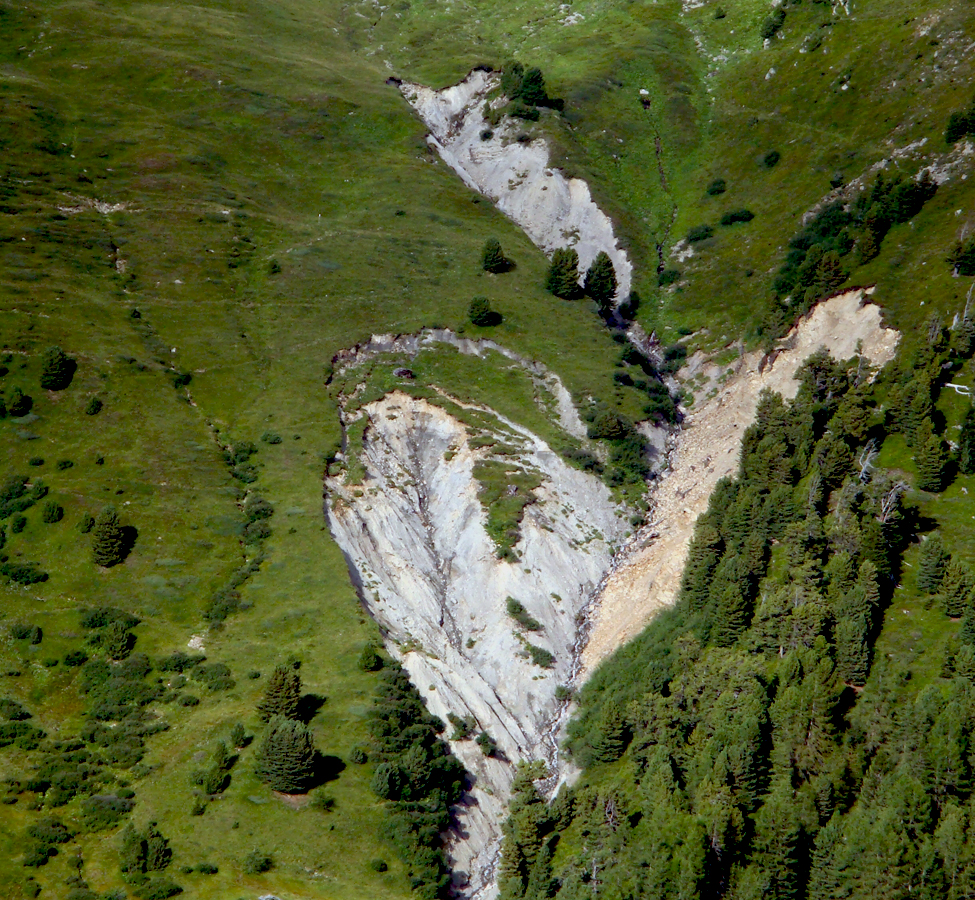
Hazard assessment and hazard maps

Hazard assessment is to determine the magnitude and frequency of processes in affected areas, taking into account already existing protective structures. The result of hazard assessment is represented in a hazard map.
Experts are supported in their work by process simulations. The results of grounds’ assessment and simulations are compared to the records of preceding natural disasters. For this purpose the Federal Government puts a database (StorMe) at the disposal of Cantons.
Actors in charge
Usually, local authorities or the Canton call for a hazard and risk assessment. Specialised private engineering companies draw the maps and write the reports. Simulation models usually are being developed during research projects.
Land-use planning: danger zones

Development planners divide our utilisable floor space into different zones according to the danger zone map. When determining development planning, protection aims are defined, as well: In red zones (high risk) building is generally prohibited. In blue zones (medium risk) building is allowed, but only with special conditions (e.g. strengthened walls to counteract the pressure of avalanches). In yellow zones (low risk) building is generally possible without any particular condition whatsoever. In these areas, however, natural disasters occur either only very rarely but intensely or have a rather small impact. "Sensitive buildings" with a high concentration of people, as for example schools, should not be built in such zones. It is the same with yellow-white striped zones. These are zones where natural processes might occur but only with a very small likelihood.
Actors in charge
Development planning measures usually are laid down by statutory regulations and ordinances of authorities, but changes in zones and utilisation plans must be approved by communal plebiscite. Data for this are delivered by specialised offices. Structural conditions are partly imposed by building insurances.
Technical measures
, Andreas Götz PLANAT 2006")
When comparing the results of risk assessment to the protection aims of a municipality, protection deficiencies becomes apparent. In order to eliminate such deficiencies, technical measures are often being taken. They are planned and carried out basing on an analysis of vulnerability. Technical measures include protective structures, such as avalanche barriers or rock fall nets, but also monitoring installations and early warning systems (including precautionarily blowing up avalanches).
Actors in charge
Many executants are involved in the process of planning and carrying out technical measures: engineering companies, local and cantonal authorities, landowners and federal agencies (subsidies).
Biological measures

Analogously to technical measures, biological measures are tested for possible usability. Wherever possible, biological measures are preferred to technical measures or are being combined. Taking care of protective forests, for example, is very important. Other measures are land-use change, for example by creating natural retention space, by taking care of steep slope (damaged by erosion) by continuously planting so called "Blaiken" or by reforesting slopes and brooks.
Actors in charge
In forestry, forest engineers are the most important executants. As biological measures very often are combined with structural measures, executants of structural-technical measures are included in the decision-making process. In nature-orientated river engineering and in all areas of combined measures there is a close co-operation between biologists, landscape builders, forest wardens and engineers required.
