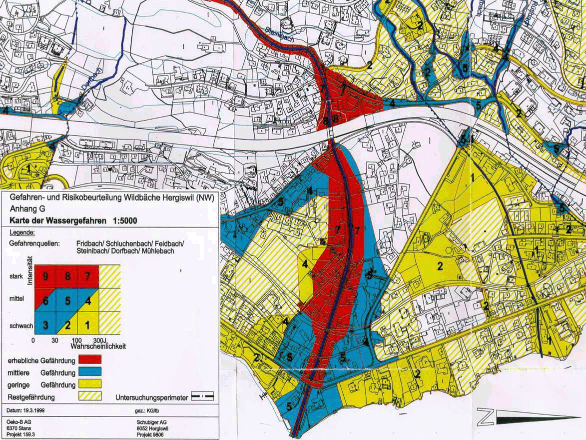
Hazard Maps
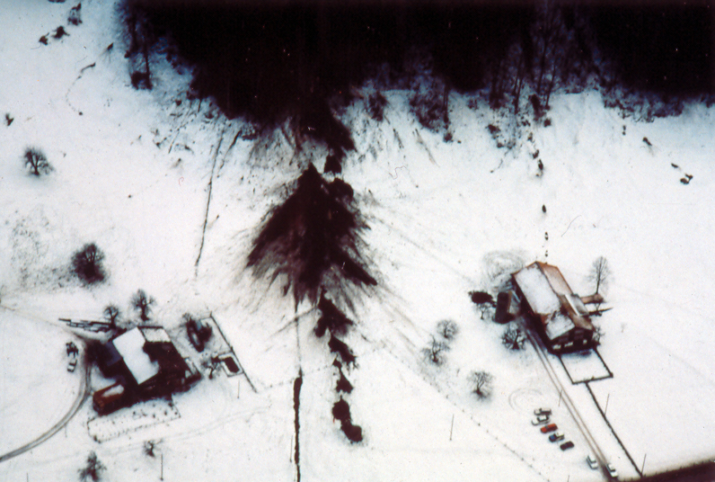
Hazard maps indicate settlement areas that are at risk from floods, avalanches, landslides and rockfall. A separate map exists for each of these hazard categories. The maps can be used to identify areas that could be flooded by the next storm, locations where avalanches could be released and slopes where a landslide could arise.
The hazard maps also provide detailed information about the causes, course, spatial scope, intensity and probability of occurrence of natural hazard events.
Using hazard maps
- Spatial planning: Hazard maps provide a basis for communal and cantonal spatial planning processes (e.g. definition of hazard zones in development plans and formulation of building regulations).
- Risk reduction measures: Hazard maps assist in the localisation and dimensioning of hazard protection measures (e.g. flood protection structures, avalanche barriers etc.)
- Instruments used in emergency planning: Hazard maps indicate where the biggest risks arise and the events most likely to occur. This information can be used as a source of orientation in emergency planning.
- Raising awareness among the population: Hazard maps help to demonstrate potential risks to the population and to increase awareness of eventual protective measures.
Importance for homeowners:
If you are planning structural protective measures in a risk area, please contact the relevant communal authority.
› More information (in German and French) on hazard maps (FOEN)
Actors
The cantons are legally obliged to identify areas that are at risk from natural hazards and their damaging effects. The cantons must complete the hazard mapping process by 2011. The FOEN’s ShowMe (German) database provides an overview of the current status of the hazard mapping process.
A hazard map is not a hazard index map
Hazard maps must not be confused with hazard index maps. The hazard index map provides a more general overview of the hazard situation on a scale of between 1:10'000 and 1:50'000. It is based on geoscientific data and simple model calculations.
Hazard maps are on a scale of between 1:2'000 and 1:10'000 and thus provide a detailed overview of the hazard sitaution. The level of detail provided is more extensive than that provided by hazard index maps. They provide in-depth information about the causes, trajectories, spatial socpe, intensity and probability of occurrence of possible rockfall, landslide and flood proceesses.
